 Global Terminal & Container Services Mitigation Site
A. MRI Phase 3 Wetland Mitigation Bank and Global Terminal & Container Services, LLC Mitigation Site
Category: Existing Restoration/Preservation and/or Mitigation Site
Location: Bounded on the north by the Transco pipeline, on the south by the Hackensack River, on the west by Bashes Creek, and on the east Transco’s Station 240 LNG facility. The MRI Phase 3 wetland mitigation bank lies between Bashes and Moonachie Creeks. The Global wetland mitigation site is between Moonachie Creek and the uplands of the Transco Station 240 LNG facility.
Latitude/Longitude: 40.81110 / -74.05496
Current Land Use: Tidal Wetland Mitigation Bank and Wetland Mitigation Site
Size: 67 acres total; MRI Phase 3 Mitigation Bank is 51 acres. The adjacent Global mitigation site is 16 acres.
Current Ownership: Transcontinental Gas Pipe Line Company (Transco) and Evergreen Environmental, LLC (Lot 5)
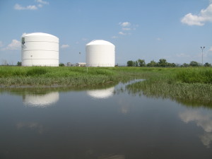
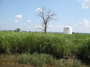
Site Description: Prior to restoration, this site was a Phragmites-dominated freshwater wetland that was cut-off from tidal flow due to a riverfront dike and a tide gate near the mouth of Moonachie Creek that were constructed by the Bergen County Mosquito Commission circa 1934. During the construction of the N.J. Turnpike’s western spur in 1969, a portion of this site was used as a dewatering basin for the sand fill used to construct the turnpike. Construction of the mitigation bank and site, restoration of tidal inundation and planting of the site with Spartina alterniflora was completed in 2012.
Existing Site-Specific Data Inventory
- Survey, Maps, and GIS
HMD regional data exists inclusive of this site.
- Real Estate/Ownership
Transcontinental Gas Pipe Line Company (Transco) and Evergreen Environmental, LLC (Lot 5)
- Site History & Land Use
Site history and land use were discussed in the 2011 Mitigation Banking Instrument.
- Biological Studies – Fauna
Biological studies were discussed in the 2011 Mitigation Banking Instrument.
- Biological Studies – General Environmental
General environmental information can be found in the 2011 Mitigation Banking Instrument.
- Geotechnical
Pre-restoration studies were conducted in 2004 and 2005.
- Hydraulics and Hydrology
Hydrology was studied in 1996, 1998 and 2005.
H.Water and Sediments
Water quality was measured in 1984, 1985, 2004 and 2005. Sediment studies were conducted in 2004, 2005 and 2010.
- Historical/Cultural Resources
Historical/Cultural resources were discussed in the 2011 Mitigation Banking Instrument.
- Restoration/Remediation Design Plans
Restoration design plans were presented in the 2011 Mitigation Banking Instrument.
Site Reports
Site A – MRI Phase 3 Mitigation Bank and Global Mitigation Site
Category: Existing Restoration/Preservation and/or Mitigation Site
Location: Bounded on the north by the Transco pipeline, on the south by the Hackensack River, on the west by Bashes Creek, and on the east Transco’s Station 240 LNG facility. The MRI Phase 3 wetland mitigation bank lies between Bashes and Moonachie Creeks. The Global wetland mitigation site is between Moonachie Creek and the uplands of the Transco Station 240 LNG facility.
Latitude/Longitude: 40.81110 / -74.05496
Current Land Use: Tidal Wetland Mitigation Bank and Wetland Mitigation Site
Size: 67 acres total; MRI Phase 3 Mitigation Bank is 51 acres. The adjacent Global mitigation site is 16 acres.
Current Ownership: Transcontinental Gas Pipe Line Company (Transco) and Evergreen Environmental, LLC (Lot 5)
Site Description: Prior to restoration, this site was a Phragmites-dominated freshwater wetland that was cut-off from tidal flow due to a riverfront dike and a tide gate near the mouth of Moonachie Creek that were constructed by the Bergen County Mosquito Commission circa 1934. During the construction of the N.J. Turnpike’s western spur in 1969, a portion of this site was used as a dewatering basin for the sand fill used to construct the turnpike. Construction of the mitigation bank and site, restoration of tidal inundation and planting of the site with Spartina alterniflora was completed in 2012.
Existing Site Specific Data Inventory
* – Report repeated under multiple data categories and/or sites.
- Survey, Maps, and GIS
Relevant survey, mapping, and GIS data for the Meadowlands can be found in the Meadowlands-wide site report under data category A.
- Real Estate/Ownership
Transcontinental Gas Pipe Line Company (Transco) and Evergreen Environmental, LLC (Lot 5)
- Site History & Land Use
*Evergreen Environmental, LLC. Executed Mitigation Banking Instrument for the Evergreen MRI3 Mitigation Bank. December 2011. Establishes guidelines and responsibilities for the establishment, use, operation and maintenance of the Evergreen MRI3 Mitigation Bank. Includes a baseline conditions report, which consists of information on ownership, site history/land use, cultural resources, hydrology, soils, vegetation, wetlands, and wildlife, as well as a wetland delineation map. Contains an existing condition topographic survey (2011) and proposed mitigation design plans (2011).
- Biological Studies – Fauna
*Evergreen Environmental, LLC. Executed Mitigation Banking Instrument for the Evergreen MRI3 Mitigation Bank. December 2011. Establishes guidelines and responsibilities for the establishment, use, operation and maintenance of the Evergreen MRI3 Mitigation Bank. Includes a baseline conditions report, which consists of information on ownership, site history/land use, cultural resources, hydrology, soils, vegetation, wetlands, and wildlife, as well as a wetland delineation map. Contains an existing condition topographic survey (2011) and proposed mitigation design plans (2011).
- Biological Studies – General Environmental
*Evergreen Environmental, LLC. Executed Mitigation Banking Instrument for the Evergreen MRI3 Mitigation Bank. December 2011. Establishes guidelines and responsibilities for the establishment, use, operation and maintenance of the Evergreen MRI3 Mitigation Bank. Includes a baseline conditions report, which consists of information on ownership, site history/land use, cultural resources, hydrology, soils, vegetation, wetlands, and wildlife, as well as a wetland delineation map. Contains an existing condition topographic survey (2011) and proposed mitigation design plans (2011).
- Geotechnical
*Evergreen Environmental, LLC. Executed Mitigation Banking Instrument for the Evergreen MRI3 Mitigation Bank. December 2011. Establishes guidelines and responsibilities for the establishment, use, operation and maintenance of the Evergreen MRI3 Mitigation Bank. Includes a baseline conditions report, which consists of information on ownership, site history/land use, cultural resources, hydrology, soils, vegetation, wetlands, and wildlife, as well as a wetland delineation map. Contains an existing condition topographic survey (2011) and proposed mitigation design plans (2011).
- Hydraulics and Hydrology
*Evergreen Environmental, LLC. Executed Mitigation Banking Instrument for the Evergreen MRI3 Mitigation Bank. December 2011. Establishes guidelines and responsibilities for the establishment, use, operation and maintenance of the Evergreen MRI3 Mitigation Bank. Includes a baseline conditions report, which consists of information on ownership, site history/land use, cultural resources, hydrology, soils, vegetation, wetlands, and wildlife, as well as a wetland delineation map. Contains an existing condition topographic survey (2011) and proposed mitigation design plans (2011).
- Water and Sediments
*Evergreen Environmental, LLC. Executed Mitigation Banking Instrument for the Evergreen MRI3 Mitigation Bank. December 2011. Establishes guidelines and responsibilities for the establishment, use, operation and maintenance of the Evergreen MRI3 Mitigation Bank. Includes a baseline conditions report, which consists of information on ownership, site history/land use, cultural resources, hydrology, soils, vegetation, wetlands, and wildlife, as well as a wetland delineation map. Contains an existing condition topographic survey (2011) and proposed mitigation design plans (2011).
- Historical/Cultural Resources
*Evergreen Environmental, LLC. Executed Mitigation Banking Instrument for the Evergreen MRI3 Mitigation Bank. December 2011. Establishes guidelines and responsibilities for the establishment, use, operation and maintenance of the Evergreen MRI3 Mitigation Bank. Includes a baseline conditions report, which consists of information on ownership, site history/land use, cultural resources, hydrology, soils, vegetation, wetlands, and wildlife, as well as a wetland delineation map. Contains an existing condition topographic survey (2011) and proposed mitigation design plans (2011).
- Restoration/Remediation Design Plans
*Evergreen Environmental, LLC. Executed Mitigation Banking Instrument for the Evergreen MRI3 Mitigation Bank. December 2011. Establishes guidelines and responsibilities for the establishment, use, operation and maintenance of the Evergreen MRI3 Mitigation Bank. Includes a baseline conditions report, which consists of information on ownership, site history/land use, cultural resources, hydrology, soils, vegetation, wetlands, and wildlife, as well as a wetland delineation map. Contains an existing condition topographic survey (2011) and proposed mitigation design plans (2011).
K. Bibliographic Updates

