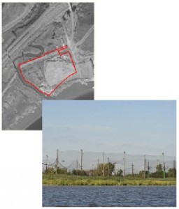
Category: Candidate Restoration/Preservation Site 
Location: Located south of the New Jersey Turnpike – Western Spur, west of Paterson Plank Road, and north of Hackensack River in East Rutherford, Bergen County.
Latitude/Longitude: 40.80745/-74.06321
Current Land Use: Tidal marsh and upland
Size: 8 acres
Current Ownership: Tomu Construction Company, Inc.
Site Description: Steiner’s Marsh is predominately an upland area with a low marsh fringe dominated by smooth cordgrass (Spartina alterniflora) along the southeastern edge of the site. Development on the property includes a Transco service road along the northern property edge and a golf driving range at the eastern corner. Site elevations range from one foot along the Hackensack River to approximately eight feet on the Transco road. The site may receive some runoff from nearby parking lots and roads.
Existing Site-Specific Data Inventory
A. Survey, Maps, and GIS
HMD regional data exists inclusive of this site.
B. Real Estate/Ownership
Owned by Tomu Construction Company, Inc.
C. Site History & Land Use
No data obtained.
D. Biological Studies – Fauna
No data obtained.
E. Biological Studies – General Environmental
No data obtained.
F. Geotechnical
No data obtained.
G. Hydraulics and Hydrology
No data obtained.
H. Water and Sediments
No data obtained.
I. Historical/Cultural Resources
No data obtained.
J. Restoration/Remediation Design Plans
No data obtained.
Site Reports
Site #29 – Steiner’s Marsh
Category: Candidate Restoration/Preservation Site
Location: Located south of the New Jersey Turnpike – Western Spur, west of Paterson Plank Road, and north of Hackensack River in East Rutherford, Bergen County.
Latitude/Longitude: 40.80745 / -74.06321
Current Land Use: Tidal marsh and upland
Size: 8 acres
Current Ownership: Tomu Construction Company, Inc.
Site Description: Steiner’s Marsh is predominately an upland area with a low marsh fringe dominated by smooth cordgrass (Spartina alterniflora) along the southeastern edge of the site. Development on the property includes a Transco service road along the northern property edge and a golf driving range at the eastern corner. Site elevations range from one foot along the Hackensack River to approximately eight feet on the Transco road. The site may receive some runoff from nearby parking lots and roads.
Existing Site Specific Data Inventory
* – Report repeated under multiple data categories and/or sites.
A. Survey, Maps, and GIS
Relevant survey, mapping, and GIS data for the Meadowlands can be found in the Meadowlands-wide site report under data category A.
B. Real Estate/Ownership
Steiner’s Marsh is owned by Tomu Construction Company, Inc.
C. Site History & Land Use
No data obtained.
D. Biological Studies – Fauna
No data obtained.
E. Biological Studies – General Environmental
No data obtained.
F. Geotechnical
No data obtained.
G. Hydraulics and Hydrology
No data obtained.
H. Water and Sediments
No data obtained.
I. Historical/Cultural Resources
No data obtained.
J. Restoration/Remediation Design Plans
No data obtained.
K. Bibliographic Updates
Site #29: Steiner’s Marsh
