MERI

MERI hosts USAID-funded Vietnam Forests and Deltas Program


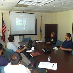
On October 21, 2014 MERI hosted a USAID-funded Vietnam Forests and Deltas Program facilitated by the Coastal Resources Center of the University of Rhode Island. The objective of the study tour is to provide opportunities for Vietnamese officials and leaders to consider broader adaption strategies for rivers and deltas.  USAID encourages the tour participants to consider some of the longer-term planning challenges facing deltas, notably with sea level rise and resettlement and various water issues.   To achieve these objectives and to present innovative thinking, the US tour will visit government, business, academia and community leaders working in NY/NJ region as well as New Orleans and the Louisiana region of the Mississippi Delta.    First stop of the tour was the New Jersey Meadowlands which is considered a large urban estuary and where joint actions between a variety of actors from government, industry and communities are addressing the long-term planning challenges facing this and other estuaries and deltas because of sea level rise.


Municipal Map Training Sessions


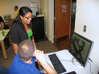
MERI-GIS will be hosting a series of training sessions for In-District municipalities. The sessions will cover how to use the Municipal Map web mapping application, to get municipal officials familiarized with new tools and to get a better understanding of the overall functionality of the tools available. The second component is the Emergency Response Information System (ERIS) which focuses on emergency planning and pre-planning.


IMG_2604


MAC-URISA Conference, Oct 22-24


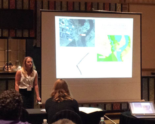
MERI, the scientific arm of the NJ Meadowlands Commission shared valuable work related to the Meadowlands region at the Mid Atlantic Chapter of URISA. This marked the 17th bi-annual MAC-URISA Conference that provides technology-rich moderated sessions, workshops and networking opportunities for GIS professionals. Studies presented by MERI ranged from spatially explicit flood modeling efforts to Balloon photography of wetlands, GIS and permitting workflow, Hyperspectral remote sensing of marsh vegetation and estuary sediment movement patterns.


StephPPT_001


Summer Interns 2014


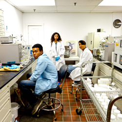
This summer MERI staffed 7 interns working in various research projects of the institute. Samantha Calderon (Bloomfield H.S.) and Marielly Pena (Newark Tech) were brought to us through the  program “Explore NJ” for High School students interested in environmental science, and were supported by the National Science Foundation under Grant No. 1203210. Samantha will begin her first year at Bryn Athyn College in Pennsylvania and Marielly is a returning junior at Newark Tech. Omar Morgan studied under our “Senior Experience” program throughout the school year as well as this summer. He graduated in  June from Bergen Academy and will begin his college career at Boston University. Brian Wlodowski & Maulik Patel will return to college this fall.  Brian is a 3rd year student at Ramapo College and Maulik will begin his 2nd year at TCNJ. Isabella Martin will return to Bergen Academy as a Senior and Sumin Lim who was brought to us through Liberty Science Center’s “Partners in Science” program is a senior at East Brunswick High School.


Mechanical Invasive Species Control


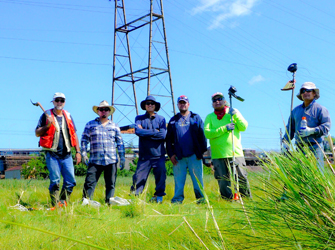
Every year in August a team of MERI scientists with help from a landscaping crew mechanically remove the invasive Phragmites at the Riverbend Wetland Preserve site to prevent the collapse of the native plant community. Portions of the site currently support a mixture of native high saltmarsh vegetation, dominated by saltmarsh hay (Spartina patens). Other areas consist of open water and dense monocultures of common reed (Phragmites australis).


IMG_2604


Sediment Movement in Tidal Creeks


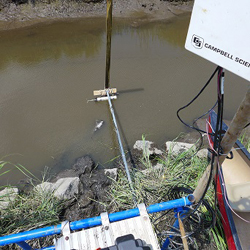
MERI scientists recently completed the first installation of a stage-velocity measuring station at a tidal creek in the Secaucus High School Wetlands Enhancement Site. These measurements are part of an EPA Wetlands Development grant designed to measure impairments to wetland function in the Meadowlands. For coastal wetlands to remain functional and continue to provide valuable ecosystems services such as effective buffer areas against flooding and support high levels of biodiversity  they must keep up with sea level rise.


Stage-Velocity Measuring Station setup


Three thousand year old ecosystems buried in the Meadowlands of New Jersey


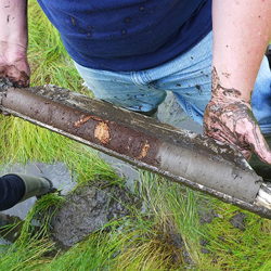
Scientists from the Meadowlands Environmental Research Institute will be traveling back in time 3000 years to look at the composition of the first wetlands to become established in the Meadowlands of New Jersey. Using a Russian Peat sampler scientists can go back in time and extract sediment core samples buried thousands of  years ago containing pollen grains, plant seeds and plant fragments. Tree branches from the original forested fresh water wetlands were recently collected from 17 feet deep samples at the Lyndhurst Riverside Marsh near the New Jersey Turnpike between exists 15 and 16. Carbon 14 dating revealed that some of the first wetlands to become established in the Meadowlands of New Jersey after that last glaciation period date back to 3000 years ago.


Stage-Velocity Measuring Station setup


Municipal DPW Dashboard


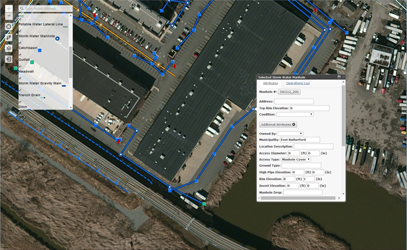
Through this on-line dashboard, towns can view and report information and location of on municipal infrastructures such as catchbasins, manholes, stormwater lines and outfalls. Using the online Dashboard municipal workers can view location, orientation and existing conditions. Operators in the field can fill out reports and photos on the fly. It is a helpful tool to report back to DEP which requires detailed inventories of stormwater features, or for internal municipal DPW record keeping. Piloting the application is the Borough of East Rutherford. Municipalities wishing to use the system can access the site using existing ERIS account. If you need further assistance or access accounts, please contact the GIS Department.


DPW Dashboard

Figure 1: Access to the mapping site shows various infrastructures, including attributes


Vertical Beam Echo-Sounder to Map Tidal Creek Bathymetry


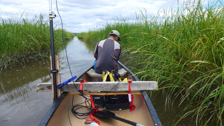
The Meadowlands Environmental Research Institute is working to uncover the depths of the Hackensack River and its branching tributaries. Using consumer grade Vertical Beam Echo-Sounders MERI is using sonar to collect data to produce digital terrain models of the riverine system.  The depth sounding is converted into elevation with the use of RTK GPS in order to create the model. The data will be used for further research on understanding the movement of sediments in the estuary.


Meadowlands Code Enforcement Association Meeting


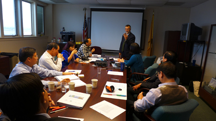
A presentation by the MERI group at the NJ Code Enforcement Association meeting showcased how GIS is used as a shared service to the 14-member municipalities.  The presentation included interactive maps, permit tracking and variance notifications.  Furthermore, the presentation illustrated how GIS technology is being used for emergency response and planning.


Code Enforcement