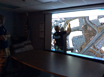
The GIS Team from Meadowlands Environmental Research Institute (MERI) visited the Borough of East Rutherford’s Fire Station on Herman Street to show mapping tools available from the New Jersey Sports & Exposition Authority’s (NJSEA) Emergency Response Information System (ERIS). ERIS is a mapping tool provided to each member municipalities of the Authority focused on emergency related spatial data. Tools that were showcased included the Borough’s ability to create pre-plan reports, incident reporting, upload photos, view floor-plans and identify hazardous materials found in a building (i.e. substances that are reported to NJDEP’s RTK Program and MERI provides these reports in ERIS). MERI also demonstrated the water level alert where responders or town officials can subscribe to this alert (via text message or email), and are notified when flood waters approaches 6 feet. Water level alerts originate from continuous water level measurements from River Barge Marina (Carlstadt). Responders and/or Borough Officials can view corresponding static flood maps, and focus in on areas that may potentially flood. Other focus of the meeting was the use of GIS technology to map out key facilities within the Borough that may require detailed mapping for Police Department use. The outreach program overview sessions will continue through the summer/ fall of 2015, and will focus on meeting with specific groups of the towns.
2015 Balloon Imagery Acquisition Season Begins in the Meadowlands
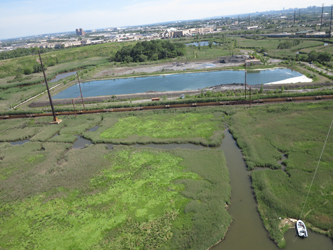
MERI’s ballooning campaign for the summer of 2015 has begun with acquisitions from Fish Creek, Hawk property and River Bend. The goal is to acquire high resolution true color aerial images of marsh surfaces in the Meadowlands estuary. This season more than 300 acres of marsh surface are planned to be photographed from a tethered balloon less than 400 feet high. The images are used to map the extent of invasive species and to record the location of valuable native species. Balloon images of marsh surfaces have been collected during the growing season since 2005.
Marshlands go into carbon dioxide sink mode
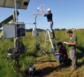
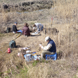
As green leaves emerge and plants start photosynthesizing early in the growing season there is a shift from a winter condition where marsh ecosystems emit C02 to a growing season condition where marsh ecosystems capture more atmospheric C02 that they emit. In other words, ecosystems shift from being a source of C02 during the winter leaf-off months to being a sink of C02 during the leaf-on months. When marshlands become sinks of C02 they perform a valuable ecosystem service by removing greenhouse gas from the atmosphere and burying it in the sediments where it may remain buried for hundreds if not thousands of years if left undisturbed. There is an exact day each year when this shift from source to sink occurs and it`s usually at the end of April. MERI scientists select this time period to calibrate the LI-7500A Open Path CO2/H2O Analyzer (CO2 sensor) that measures CO2 fluxes at the boundary between marsh vegetation and the atmosphere. The accuracy of the measurements from these sensors mounted on a 2.8 meters tower above the marsh surface depends on how well they are calibrated. To correctly measure this important ecosystem service, MERI scientists conduct detailed calibrations at the start of the growing season, in the middle (July-August) and at the end (December-January).
MERI scientists present study at the HDC-SETAC 2015 Annual Meeting
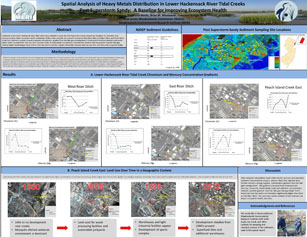
Parts of the towns of little Ferry, Moonachie and Carlstadt are located in a low lying basin of the Hackensack River Estuary with an historical original elevation of about 1.5 feet above sea level. During super storm Sandy, flood waters from the sea surge moved over berms and tide gates and up tidal creeks and storm drainage pipes reaching residential areas and known contaminated industrial sites. Water levels rose up to 38 inches above street level and areas remained flooded for more than seven hours. Deployed sensors registered a sharp increase in water turbidity as the flood waters receded. Contamination by heavy metals – in particular by chromium and mercury- is well known for this area. An assessment of metal concentrations (Cd, Cr, Cu, Fe, Hg, Mn, Ni, Pb, and Zn) in the sediments of seven tidal creeks on the sea side and landside of tide gates were sampled to establish a post Sandy metal concentration baseline. The concentrations of Cr, Hg, Mn and Ni showed a negative gradient from the tide gates moving inland. Overall, samples from the sea side of tide gates had higher metal concentrations than the land side. Peach Island Creek East showed consistent higher metal concentration than the other six creeks. Tide gates, legacy mosquito ditches, storm water drainage networks, building footprints and aerial imagery from 1930 to 2014 were used to establish the spatial relationship between historic land uses and contaminants. This study establishes the post Sandy baselines for metal contaminate for future reference on their transport and fate in these ecosystems.
MERI-GIS group received top awards in various categories in NJDEP’s annual mapping contest
The NJDEP’s mapping contest is an old tradition among map makers in the State of New Jersey. This year marked the 28th annual event with nearly 100 participants from NJ State agencies, County and academia. Michael Stepowyj of MERI (NJSEA) took the overall Gail P. Carter Award for “Best Application of Science and GIS”. Michael also took 2nd Place in Data Integration (12 entries) and 2nd overall in “Newbie” category. This was Michael’s first mapping contest as part of the MERI group and a remarkable achievement for the 3 categories he won. This marks the third year in a row that the MERI-GIS group received top awards in various categories in NJDEP’s annual mapping contest.
GIS Team Creates Interactive Paddle Map Application
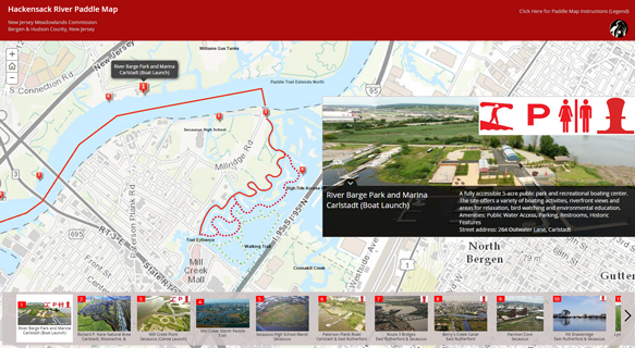
Working in tandem with Riverkeeper and our Commission’s Parks Department, the MERI GIS team has developed an interactive web mapping application that details a boating trail along the Hackensack River within our district. The map application was created with ArcGIS Online services and includes the main path, secondary paddling trails, and seventeen points of interest along the river. These points include important natural, cultural, and historical features that gives paddlers a glimpse of the area’s history while they enjoy their excursion. The public can access this map service on their home desktops or on their mobile devices. The seventeen markers along the river have corresponding pictures and information attached to supplement the map. Paddlers can access the Paddle Map web application through the New Jersey Meadowlands Commission ArcGIS Online Portal: https://njmc.maps.arcgis.com/home/
Meadowlands marsh soils to be characterized and mapped by USDA-NRCS
Dr. Richard Shaw, the State Soils Scientist from USDA-NRCS and his staff along with Kathleen Strakosch Walz, a wetland ecologist from the Office of Natural Lands and Management, NJDEP visited one of MERI’s sediment elevation tables monitoring sites in anticipation of a marsh soil mapping project. According to Dr. Shaw “The objective of this project is to begin collecting characterization data for our tidal marsh soils in a cooperative effort with some of our partner agencies. It will initiate long term monitoring of tidal marsh properties at sites where our cooperators have established sediment elevation tables (SETs) and collected supplemental site information. The New York City Department of Parks & Recreation, the Meadowlands Environmental Research Institute, the Barnegat Bay Partnership and the U.S. Academy of Natural Sciences all have established sediment elevation tables at selected sites in NYC and NJ. Marsh sites will be sampled from these sites by horizon to approximately 2 meters and samples will be sent to the USDA-NRCS Kellogg Soil Survey Laboratory in Lincoln, NE, for complete physical, chemical and mineralogical analyses. The data will help in understanding depositional and pedological processes, and to some extent the anthropogenic effects, taking place in the tidal areas, and provide the foundation for an evaluation of our tidal marsh mapping and for the long term monitoring of soil change”. Read more..
Super computer to forecast District sea surge warnings
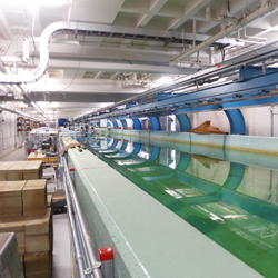
Environment scientists from the Meadowlands Environmental Research Institute (MERI) visited the installations of the Urban Ocean Observatory at the Stevens Institute of Technology in Hoboken. Data from MERI’s water elevation monitoring stations in the lower Hackensack River estuary are now contributing real-time water elevation information to the Davidson Laboratory Storm Surge Warning System. As a result, most areas in the NJMC District will soon have reliable sea surge forecasting from the Pharos super-computer at the Davison labs. Scientists also visited Davidson’s Lab experimental wave generating water tank. This tank is used to evaluate boat and ship hull designs as well as to study the effects of waves on coast defense structures. The Davidson tank can also be used to investigate the buffering capacity of natural and engineered wetlands to help reduce flooding in urban areas. The new sea surge warning system should be operational by June for the onset of the next hurricane season. See presentation…
MERI AWARDED EPA FY14 GRANT for $215,239
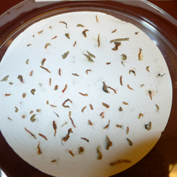
MERI has been awarded an EPA grant in the amount of $215,239 to conduct a study titles Benthic Biodiversity and Benthic Pollutants in Emergent Marshes of the NJ Meadowlands. The proposed study will look at benthic diversity and population density at two wetland sites and contaminant loads associated with the benthic community at three other wetland sites in the Meadowlands. This study will complement historical baselines of sediment contamination and benthic diversity providing new and updated information critical to the future enhancement and management of these highly impacted urban coastal wetlands.
Unmanned Autonomous Vehicle (UAV) presentation by Steve Cohen
Steven Cohen demonstrated to MERI Staff the latest drone technology for acquisition of aerial imagery and video. Steve coordinates the Unmanned Autonomous Vehicle (UAS) and Mechatronics Education STEM GPS program at Bergen County Community College (BCC). A future collaboration between MERI and this program would involve on the one hand, the transfer of drone technology to MERI and on the other, BCC students would be trained on image processing techniques and methods at MERI. Drone technology is quickly becoming a preferred tool for environmental monitoring and will complement MERI’s current balloon photography for monitoring estuarine plant and animal communities.
