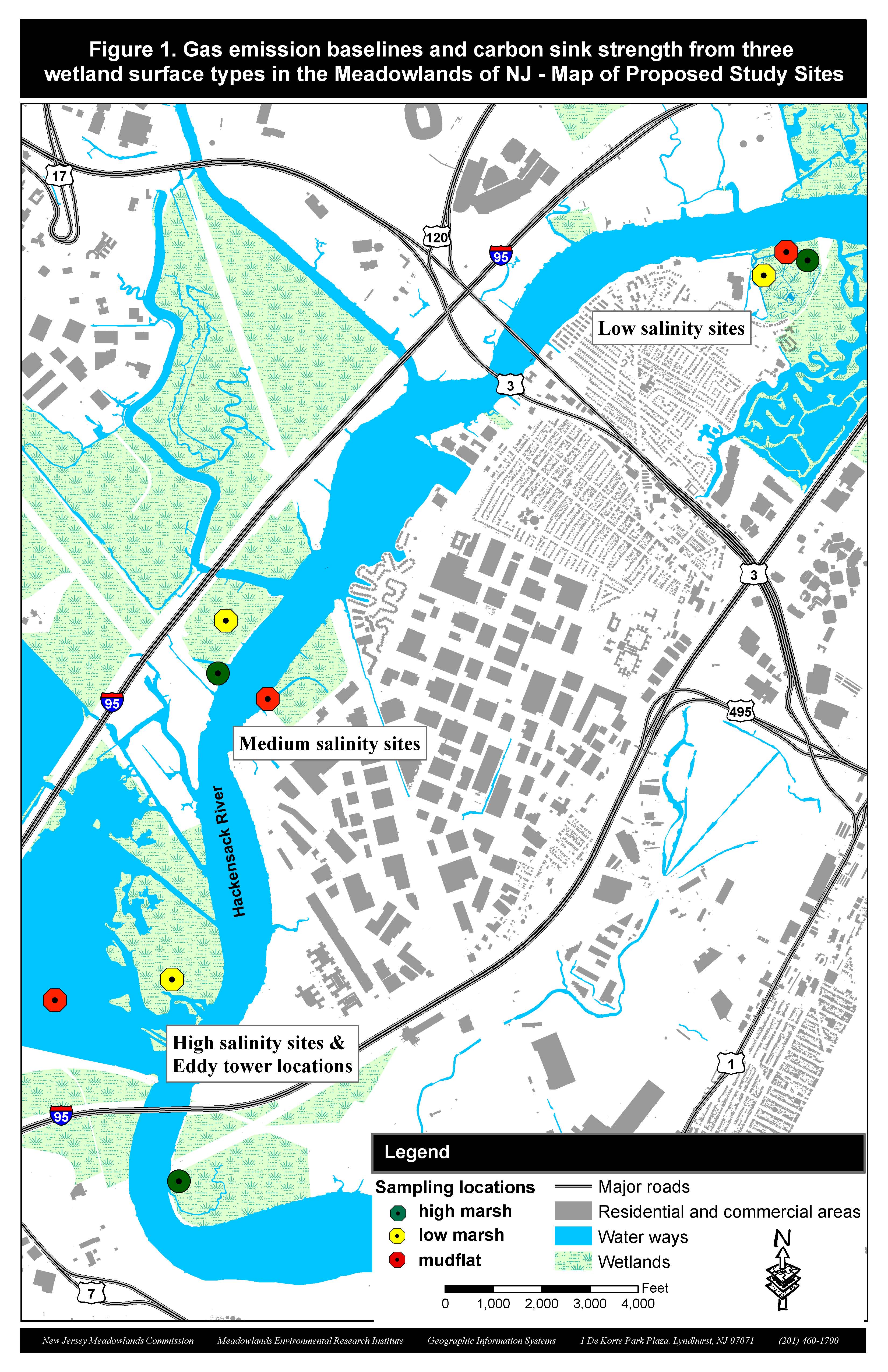
As the 2020 growing season kicks in and the Meadowland marshes gear up for the spring, it’s time to deploy MERI’s carbon flux sensors.
As part of a grant agreement with the Environmental Protection Agency (EPA, CD- 96284501-0) MERI scientists measure carbon sequestration potential of three major habitats of the lower Hackensack River Estuary: mudflat, low marsh and high marsh habitats.
Low marsh habitats are dominated by the tall, dense stands of the smooth cordgrass (Spartina alterniflora), while at the high marsh habitat saltmeadow cordgrass (Spartina patens) and desert saltgrass (Distichlis spicata) share dominance.
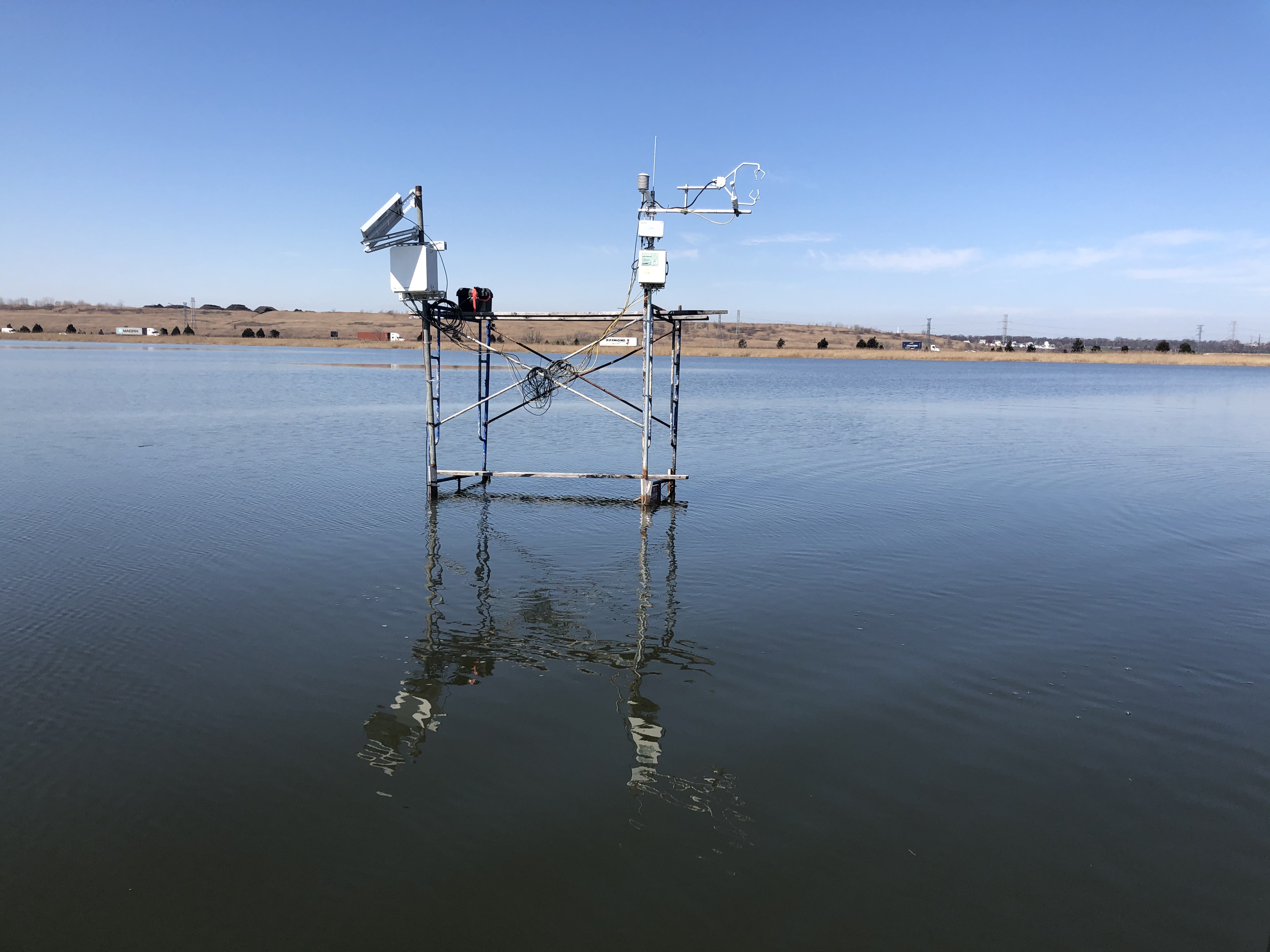
The study aims to explore the differences in carbon uptake between the vegetated habitats and the mudflat by utilizing open path CO2/H2O gas analyzers (one LI-7500A: LiCOR Inc., and 2 IRGASON: Campbell Inc. sensors) mounted on eddy covariance towers. The sensors capture CO2 fluxes on the vegetation-atmosphere interface based on air CO2 and water vapor concentration, ambient temperature and pressure at a 20records/sec rate, 24/7.
The raw data is collected monthly at the stations and converted into .dat files at MERI’s GIS lab. CO2, and H2O fluxes are then calculated and averaged into an hourly dataset using EddyPro open source software. Net Ecosystem Exchange (NEE) and annual Gross Ecosystem Production (GEP) are calculated at the end of the annual data collection, and those values serve as a basis of the habitat comparison.
The ultimate goal of the project is to capture the marsh canopy’s annual carbon uptake rate at each of the three habitat types and to better understand their carbon sequestration potential and the role they play in the region’s carbon footprint.
(Please click on the embedded site map photo to view the full resolution of the site map)
MERI has been experimenting with water quality sampling using drones. In a complex urban/industrial/estuarine area there are many hard to reach water bodies. The challenge is to collect a sample of at least 400 ml in an acid washed bottle using a drone. A 3D printer was used to make the bottle attachment mechanism.
Meadowlands Environmental Research Institute, collaborating with New Jersey Institute of Technology, Brisea Group Inc., prepared a proposal, “Mechanical removal of harmful algal bloom (HAB) in lakes using air micro-nano bubbles from a specialized floating platform” for DEP’s Water Quality Restoration Grant Program to control Harmful Algal Blooms. This proposed project has been evaluated and selected for a grant award in the amount of $500,000.
This project aims to deploy a customized multifunctional floating platform in Branch Brook Lake and Deal Lake, two of the HABs-affected lakes in NJ in 2019, to evaluate the efficiency of algal removal and improvement of water qualities (e.g., dissolved oxygen levels, turbidity, and odor).
On October 19, the Rutgers Earth and Environmental Science Environmental Geophysics class conducted a field survey at Harrier Meadow marsh in North Arlington, NJ. The field work included resistivity and electromagnetivity surveys over marsh vegetation to find areas with high salinity levels. These areas are priority habitat for the endangered native salt marsh Salicornia family.
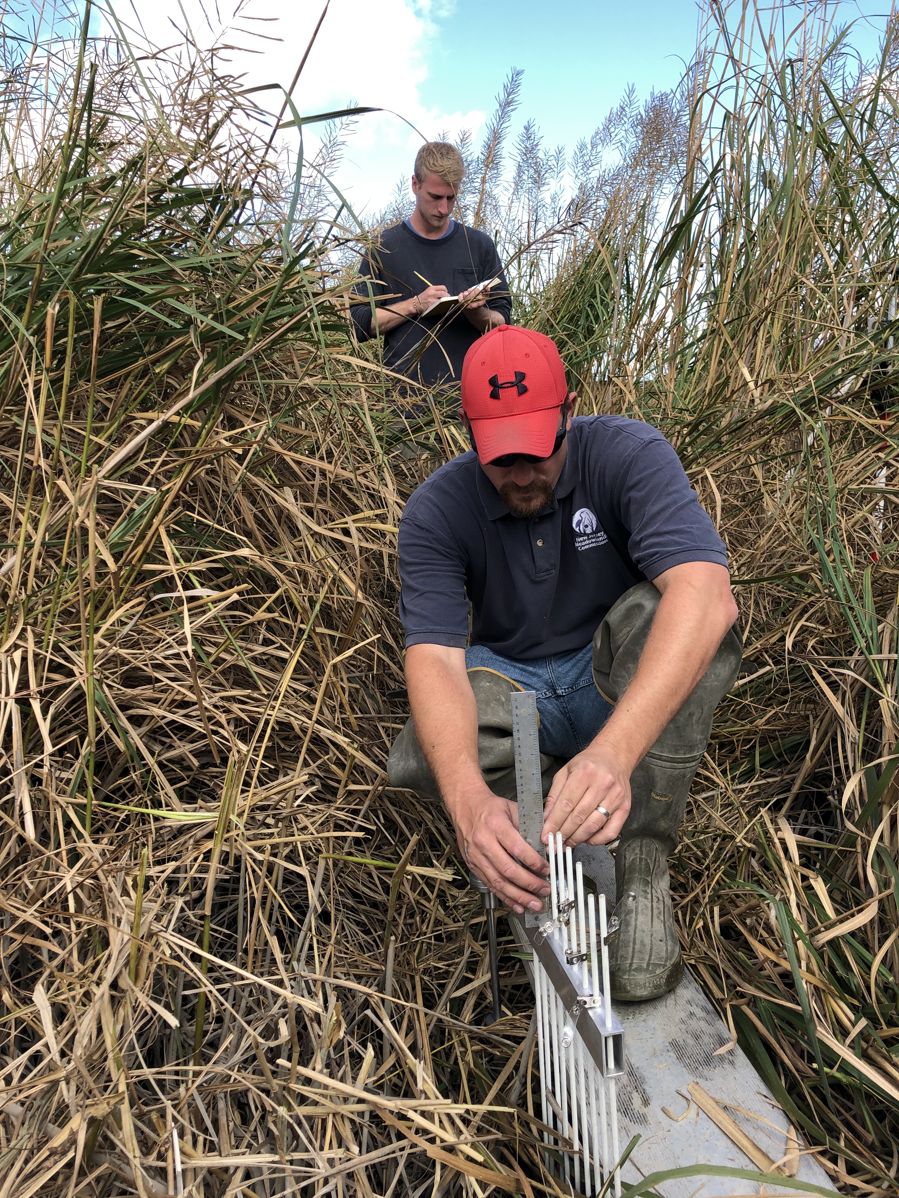
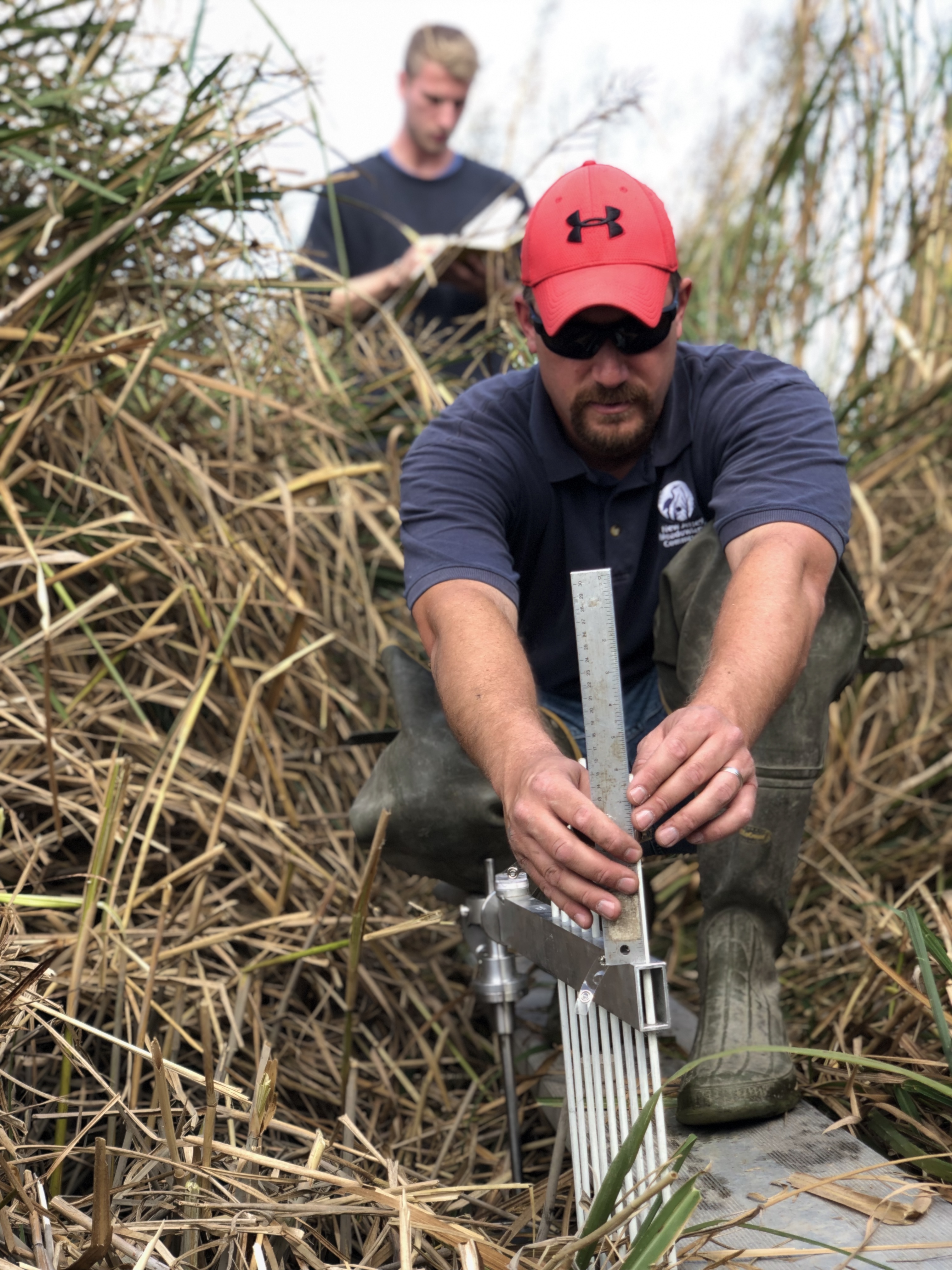
By measuring the surface elevation of various marshes in the Meadowlands region, scientists at MERI are keeping track of the rising sea levels based on accretion and elevation rates.
This summer, MERI flew several drone missions for the town of Rutherford through the MERI Municipal Drone Program. These drone products were provided to the municipal officials and police department for logistical planning and security for future town events, as well as current day imagery of their recreational fields.
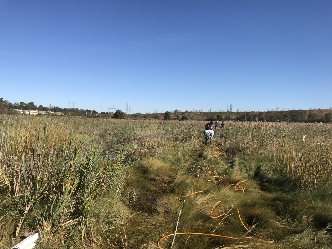
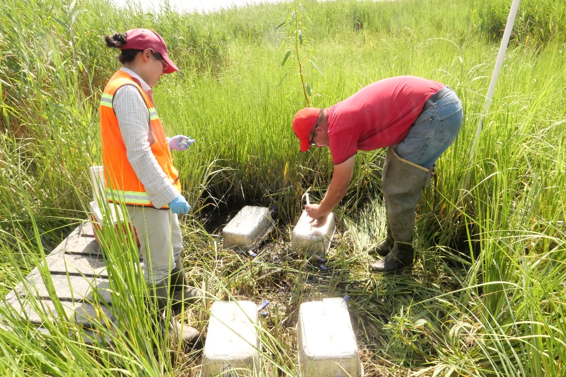
MERI scientists have finished Greenhouse Gas (including CO2, CH4, N2O) Sampling over different marsh surfaces (high marsh, low marsh, mudflat) this summer with chambers (EPA Project: Gas emission baselines and carbon sink strength from three wetland surface types in the Meadowlands of New Jersey). Porewater samples from different marsh surface along the salinity gradient at lower Hackensack river were also collected and analyzed. We have successfully collected samples of four seasons from these 9 locations at 3 sites.
In the areas of the lower Hackensack Estuary, ninety percent of the land is just two feet above the high water mark. Fourteen municipalities share the basin (Meadowlands District) where flood protection mostly relies on a half a century old tide gate system. The system weaknesses were on display during Hurricane Sandy where faulty tide gates were exposed. There is not one agency or town responsible for all tide gates, and aside from site visits to each tide gate, there is no way to check if the network of tide gates are in proper working order before high energy weather events.
Objective:
Instrument main tide gates in the District with water level sensors both on the downstream (sea-side) and upstream (land-side). Configure the water level sensors so that they continuously report in real-time the water level on each side of tide gates.
Strategy:
Create a network of instrumented tide gates where the water level measuring hardware and communication systems are solar powered and report back via telecommunication to MERI’s cloud server, where data is stored and can be visualized in real time.
Activities:
– Identify critical tide gates and survey their water control elevation.
– Identify pressure transducers, communication equipment and power sources for reliable long term deployment of water elevation sensors strapped to tide gates.
– Identify an appropriate telemetry system, back-end data management system and user interface
– Build and test instrument cluster prototypes at selected tide gates
– Assess tide gates in real time for proper upkeep and monitor their operating status previous to, and during high energy storms and sea surge events
Deliverable:
A tide gate monitoring system that operates independent from the local power grid and provides accurate water levels around tide gates in real-time. The service is available over the Internet so that engineers can evaluate their operational status at any moment.
MERI’s FAA certified drone pilots start the annual vegetation monitoring campaign as the Meadowlands start blooming after the long winter. MERI’s scientists assist the Natural Resources Department of the New Jersey Sports and Exposition Authority to capture seasonal and successional changes in the vegetation of the remaining 8400 acre tidal wetlands in the lower Hackensack River estuary.
The Hackensack Meadowlands is a low lying, historically flood prone tidal estuary, where the state and maintenance of flood protection structures are crucial for building a resilient coastal community. MERI’s drone program assists the community with ditch and berm inspections to provide up-to-date information on the condition of flood protection structures.