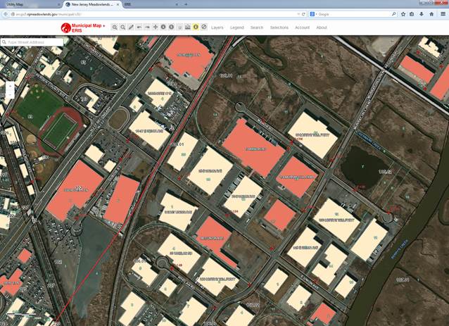
With the District’s dense population and close proximity to New York City, an important component of the GIS Outreach Program is focused on emergency management. The Emergency Response Information System (ERIS) is a web-based extension of MERI’s Municipal Map application that emergency officials and first responders utilize to manage, plan, and respond to emergencies. Municipal map contains various datasets such as parcel information, land use, zoning, wetlands, riparian, encumbrance, FEMA, and much more. ERIS adds critical data layers including: boat launches, knox boxes, mile markers, and Right-To-Know information to this already robust database. The compilation and visual representation of this information has had a profound impact on the way District municipalities plan for and respond to emergencies.
Online ERIS Features:
The Online-ERIS is a custom ArcGIS Server application. The benefits of the ESRI’s ArcGIS Server application include more rapid updates and it is accessibility to any computer with internet access. One key piece of information that is integrated into ERIS is Right-To-Know information, which is linked to the building foot prints. When emergency responders click on a building, they can see a list of all the hazardous chemicals stored in that particular facility as well as the location of the chemical. They can access a digital version of the Emergency Response Guidebook, which details potential hazards, public safety information and emergency response information for a specific chemical.
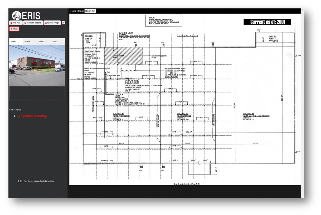
In this version of ERIS, users have the ability to click on a building and view floor plans associated with that facility. In addition, users can have access to editable size-up sheets which are served as an incident reports and pre-plan sheets, providing details about specific buildings. The information entered in both of these sheets are sent to emergency response officials and are populated back into the ERIS database.
Emergency Responders wishing to sign on with account access to ERIS, please contact Dom Elefante (dominador.elefante@njmeadowlands.gov) or by phone (201) 460-4669