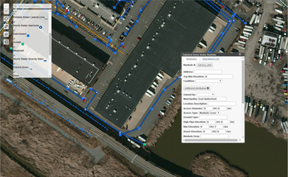
Through this on-line dashboard, towns can view and report information and location of on municipal infrastructures such as catchbasins, manholes, stormwater lines and outfalls. Using the online Dashboard municipal workers can view location, orientation and existing conditions. Operators in the field can fill out reports and photos on the fly. It is a helpful tool to report back to DEP which requires detailed inventories of stormwater features, or for internal municipal DPW record keeping. Piloting the application is the Borough of East Rutherford. Municipalities wishing to use the system can access the site using existing ERIS account. If you need further assistance or access accounts, please contact the GIS Department.
