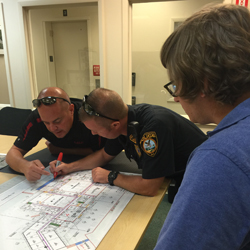
MERI GIS is assisting members of the East Rutherford Police Department in creating detailed building floor plan maps of the town’s critical facilities. These maps provide the East Rutherford Police important information for emergency response situations. With the police department’s help, the MERI-GIS team is constructing maps highlighting building access points and other features that will help officers and responders quickly navigate these buildings in case of an emergency.
